To thank you for making GPSNavX the #1 Marine Navigation App,
GPSNavX is now $29.99 for a limited time only!
This is a 50% saving from the normal price of $59.99
*** Most advanced marine navigation app in the App Store
*** Editor’s Choice Winner, Practical Sailor
*** A powerful color chartplotter for a FRACTION of the cost!
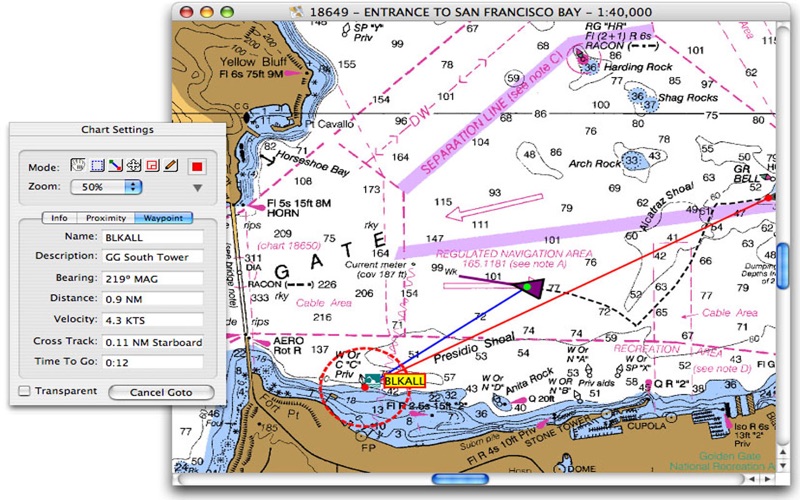
The professional solutions for any mariner who wants real-time marine navigation for their Mac. Take your Mac aboard for real-time display of position on full color marine raster format BSB and Softcharts.
GPSNavX is right at home for planning trips and charting new destinations. Includes the freely available, official and up-to-date high resolution NOAA RNC raster United States marine charts of the West Coast, Gulf Coast, East Coast, Great Lakes, Alaska, Hawaii, and US Virgin Islands.
GPSNavX is the only app that offers access to 1000s of detailed charts: official CHS Canada charts, Navionics Gold charts, FishNChip charts, HotMaps, NY charts, Hiltons fishing charts, Trak Canada lakes fishing maps and Solteknik European waters marine charts may be purchased separately via X-Traverse. WaterWay Guides are also available for detailed points of interest (Anchorages, Marinas & Hazards).
Here are just a few of the many features included in GPSNavX:
- Marine navigation and charting for Mac
- Real-time display of position on full color marine raster charts
- Quartz Technology to display charts in sharpest possible way
- Real-time and simulated display of all GPS and instruments data
- Real-time navigation on marine charts
- Full suite of downloadable marine charts
- Waypoint selection, creation and editing
- Route editing and track log using waypoints
- Connect to AIS system or Radar and “see” local vessel traffic
- Tides and current information via Mr. Tides
- GRIB weather and forecast integration
- Built-in alarms for anchor drag, waypoint arrival, cross track error and AIS/Radar vessel proximity
- Export waypoints, routes and tracks to Google Earth
GPSNavX is updated frequently and all updates are provided at no additional cost. More here:
Website: http://gpsnavx.com/
Users Guide: http://gpsnavx.com/help/
If you enjoy using your version of GPSNavX - please leave us a review - your support is always greatly appreciated!!!


